8 February 2013
If you want an example of why brownfield first as a planning policy doesn’t always work, look no further than the proposed development for 104 new houses on the redundant land surrounding the (still open) Milford Hospital just south of Godalming. 40% of this housing is to be affordable housing.
The hospital was originally a sanatorium so it was built in a relatively isolated area. The road access has always been difficult, but it didn’t used to matter when it first opened because the nurses lived on site and the TB patients did not have many visitors.
One way to measure the environnmental sustainabilty of a site is by looking at its existing and proposed transport infrastructure. Distance to a public transport is a key issue. In the case of Upper Tuesley the railway line is quite close and the route recommended by the developer will be via a public foothway and cycleway. However not everybody can afford to use a train and an elderly person’s free bus pass isn’t much use on a train! So access to a good bus network is still important.
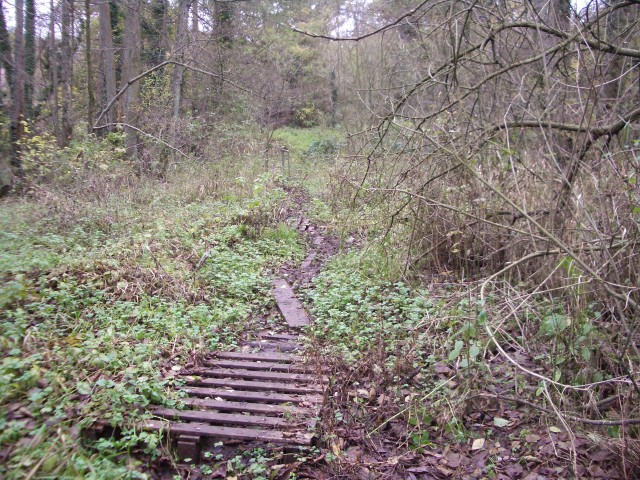
There are no regular buses serving this site – there are just two buses a week. The developer, the Homes and Communities Agency (a government orgnanisation) and Waverley Borough Council have been claiming for the last 18 months that there bus stops a 10 minute walk away. Given the ground conditions it is hard to believe they are serious – either that or they have never walked it for themselves. So to help them we did it for them in early December and and made a short film (under 5 mins, below) which helps to explain why we think it is is both duplicitous and ludicrous to rely on this footpath to claim this site is a 10 minute walk from the bus stops on Portsmouth Road:
This photo shows the ground conditions in the area near the River Ock – and it was actually taken last year during the drought and you still needed wellington boots to get across this section without getting your feet wet!


